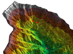
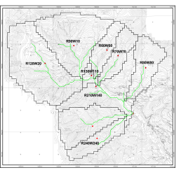
Surface analysis
Surface analysis is an important phase in the definition of the area to be studies. Watershed, sub-basins definition and terrain slopes are fundamental parameter to be identified and accurately described in the calculation models. Extensive use of GIS software is made to enable sufficient accuracy and at the same time keep the model as light not to slow down calculations
Runoff analysis
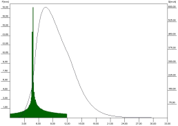
Rain data is analyzed to perform simulations of extreme events (risk assessment and flooding analysis) or extrapolate data for production verification (hydro power plants). This type of analysis is normally performed with dedicated oftware, as well as with self-developed algorithms.
Numerical simulations
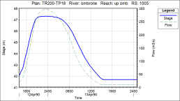
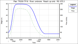
Depending on the type of study to be performed, steady or unsteady simulations can be performed ono the streams network.
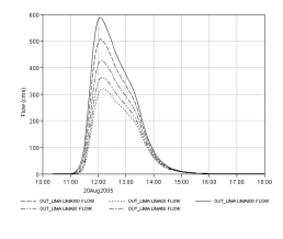
Open channel with many criticalities may exhibit lateral flow over the embankments, resulting in a cap to the water level as well as to the flow plot in downstream sections.
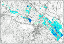
Risk analysis
Risk analyses can be perform using the results of the simulations. For potentially floodable areas the verification of the water levels against the return period of the events allow the risk classification for the purpose of land development and/or safety and protection operation plans.